The state and county maps and documents on this page are sourced from the Legislative and Congressional Reapportionment office. The LCRO is an office of the Georgia General Assembly that provides redistricting services. Maps and information on county and city pages listed below are from other sources such as county websites.
State of Georgia districts
Download full PDF for more detail; JPGs available for presentations. All maps on this page are up-to-date; dates in the filenames represent when new districts were drawn.
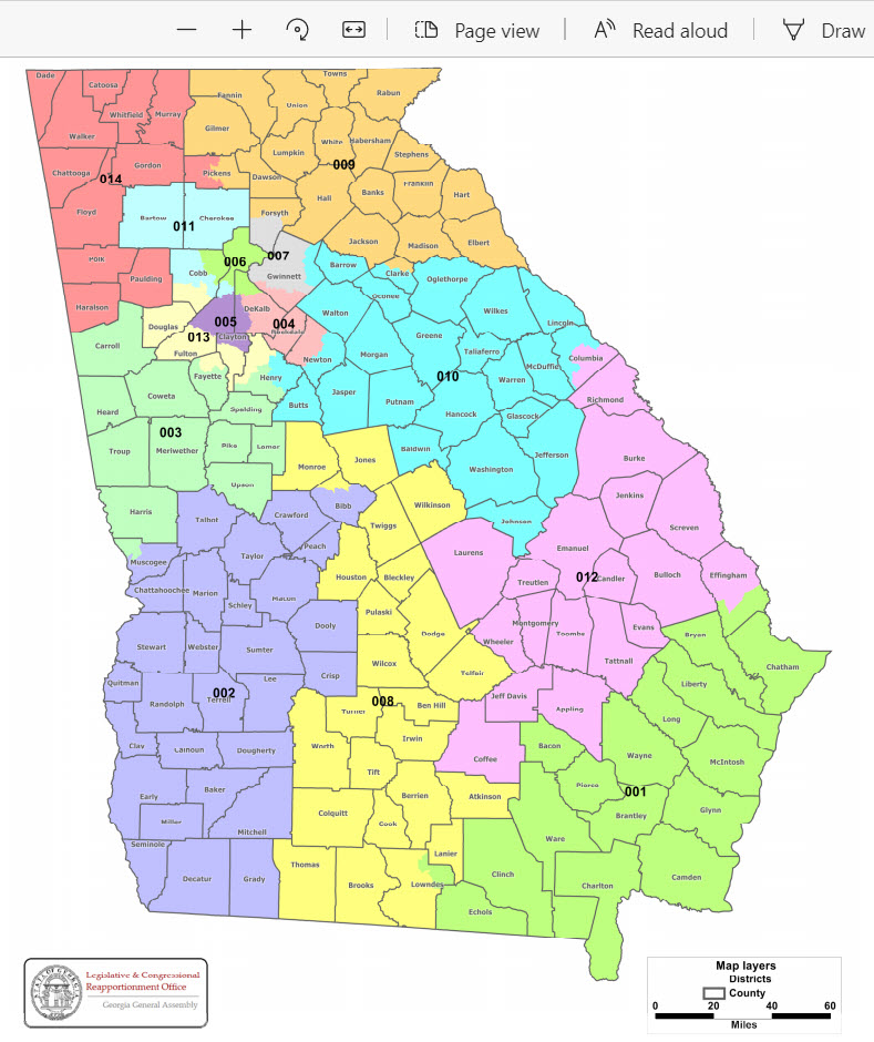
Georgia Congressional Districts

View entire PDF (sourced 6/16/2021)
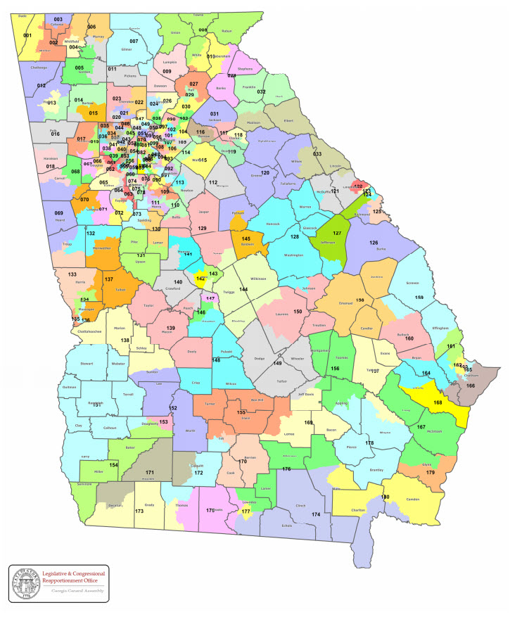
Georgia State House Districts

View entire PDF (sourced 6/16/2021)
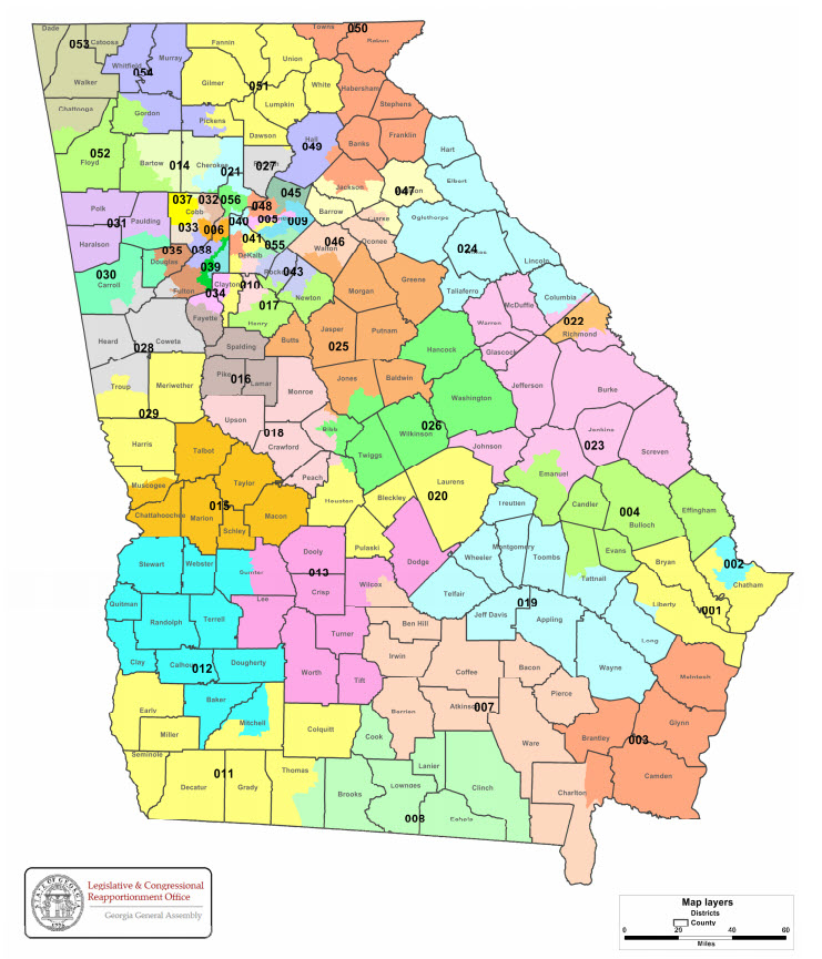
Georgia State Senate Districts

View entire PDF (sourced 6/16/2021)
The attachments below are downloads. Click to start the download. Depending on your computer setup, these will appear in your computer’s “Downloads” folder or in the lower left corner of your browser, where you can open and save them to the folder of your choice.

Georgia’s most populous counties
Coweta County
Houston County
How cities are split into multiple districts
Note: The purpose of the city pages listed below is to provide examples of small-to-medium-size cities that could be accommodated in a single Congressional, state Senate, or state House district, but have been divided into multiple districts. We apologize if you don’t see your city listed below; we’ll add to the list as time and resources permit.
Athens (U.S. Congress)
Cartersville (State Senate)
Conyers (State House)
Covington (State Senate)
Dalton (State House)
Duluth (State House)
Fayetteville (State Senate)
Forest Park (State Senate)
Grovetown (State Senate)
LaGrange (State Senate)
Lawrenceville (State Senate and State House)Lilburn (State Senate)
McDonough (State House)
Newnan (State House)
Rome (State House)
Smyrna (U.S. Congress and State Senate)
Snellville (State Senate)
Sugar Hill (State House)
Suwanee (State Senate)
Tifton (State House)
Union City (State Senate)
Waycross (State House)
Woodstock (State Senate and State House)
College Campus Maps
Several of Georgia’s college campuses are cracked into multiple districts


